 The Gullet & Swinyard Hill
Rising from the Silurian pass moving northward toward the Herefordshire Beacon is the sinisterly titled Hangmans Hill, once the location of a gibbet originally constructed by the Red Earl. The Red Earl of Gloucestershire married the daughter of Edward I, Joan d'Arce, and in doing so received the rights to the Malvern chase upon which he made sure no one encroached.
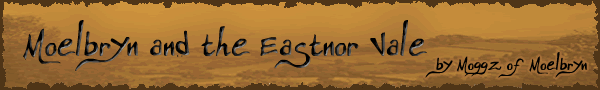
Beyond Hangmans Hill the ridge turns slightly westward and rises sharply toward the ancient ramparts of the British Camp on Millennium Hill and the towering Herefordshire Beacon whilst to the east the fern covered Broad Down slopes gently into woodland.
 Northward from Midsummer Camp
On the western slopes between Hangmans Hill and the British Camp a small cave can be found in an outcrop of rock near the ridge. The caves most common names are Clutters Cave, Walm's Cave or the Giants' Cave. Though to children the stories of a giant in the cave may be exciting, there is actually little room for someone of average size to live comfortably, let alone a giant! However that name may stem from a story involving the Collwall Stone, that currently lies a few feet from it's original location as a centerpiece to a road junction near the centre of the village. The story goes that the giant saw his wife with another man in Collwall and in anger, ripped the stone from the hillside and hurled it at her, killing her on the spot. The resultant hole from which the stone originated being the Giants Cave.
 Clutters Cave
The name Walms Cave comes from that of St Walms (or Waums) Well, which is on the slopes below the cave. Henry Somers-Cox suggested that this name could originate from a hermit or missionary that lived nearby, perhaps in the cave. It is thought that the cave may actually have been built by the Druids. There was once a panel, now barely visible, cut into the back wall of the cave, into which light was said to fall at 3 p.m. on the winter solstice. At the equinoxes the upper edge of the illuminated area coincides with the angle between the floor and back wall of the cave.
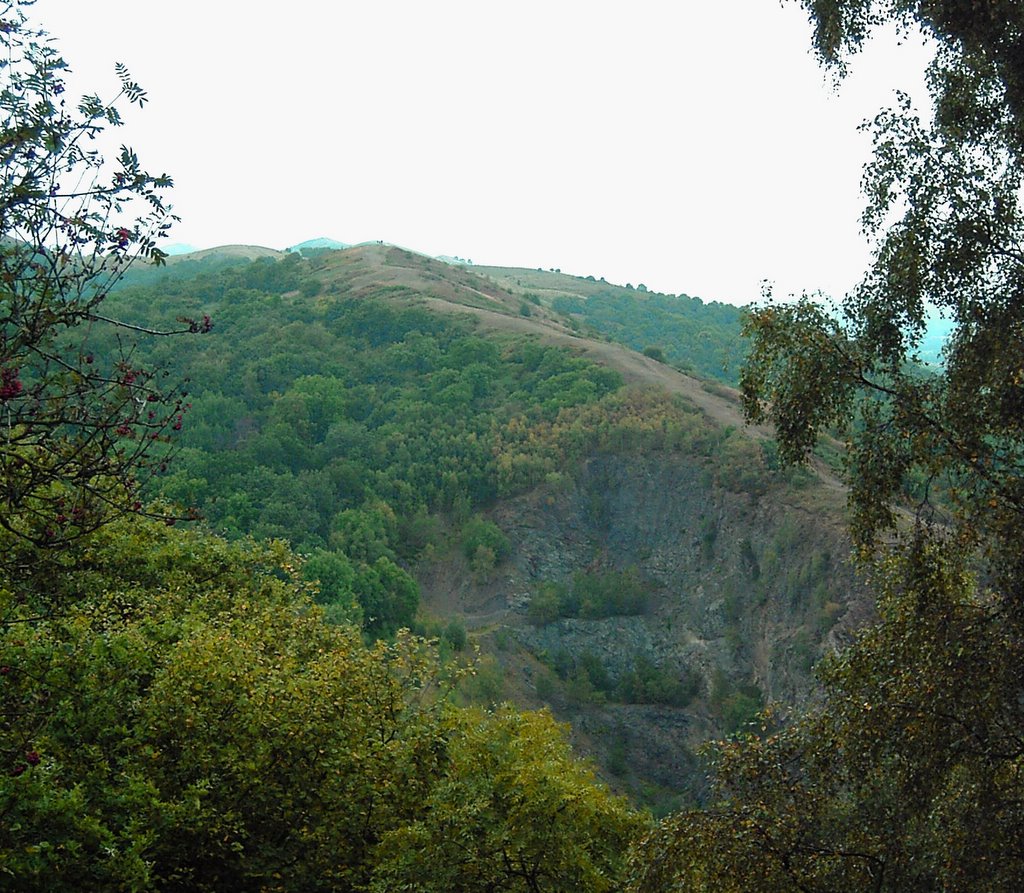
 Autumn sunset from inside Clutters Cave
5 comments:
Great addition to a great site. Note WS Symonds, 1883, HANLEY CASTLE, also gives Owen Glendower's Cave for Clutters.
Keep up the good work! I'm trying to establish at what - if any - Latitude is the sunrise angle exactly the Latitude value at Midsummer. Stonehenge is close: currently 51 11 plays 52 30 ish (though this is stylised 51 or 360/7 elsewhere and MOVES - it was once 51 30). This is the centre Stonehenge to Hele Stone sunrise celebration. I'm thinking Midsummer Hill might be more accurate - 52 degrees. Note the sunrise angle is to axis North-South (it's circa 39 to E-W). I find some mention of a place called "Sunrising" - but I really would like the cut in the hill visible from Sacrifice Stone identifying. Wonderful Stuff!
Hey, could you tell me where the best place is to start a walk of the hills south of british camp?
Hello there,
There's a large car park at the top of the British Camp on the A449 Ledbury/Worcester Road.
There is also a car park on Midsummer Hill on the A438. The car park is at the crest of the hill as the road passes through hollybush. From here there are nive walks across Ragged Stone and the gloucestershire beacon around the White Leaved Oak area, or to the north there are walks around midsummer and hollybush hills and Eastnor Deer Park.
hope this helps,
Moggz
What a fascinating blog! One of the most interesting I've seen. Wondering if you have any info about the rumoured connection of Clutter's Cave to Owain Glyndŵr (Owen Glendower) or Sir John Oldcastle and its possible use as one of their hiding places.
Hi Tim! Other than the reference to this book (http://www.amazon.co.uk/Hanley-Castle-Dodo-Press-Symonds/dp/1409913082), in the comment from Geoff above, I've not read any additional information about this. Glad you like the site. Maybe I will finish it some day :)
Post a Comment