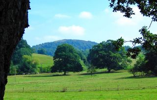
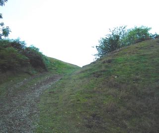
Much as she welcomed the company and love of the many visitors, as she grew ancient she also grew tired. One evening, she had been entertaining her family just as she always would, but then that night, she was gone.
Welcome to the vale...
This weblog focuses on the stories, folklore and history of the area - the hills, buildings, woods and ruins, tales of faerie folk, witches, druids and giants.
Please leave a comment if you have found this blog useful or have enjoyed reading.
Peace x
Friday, July 17, 2020
The Oak of Raggedstone
Much as she welcomed the company and love of the many visitors, as she grew ancient she also grew tired. One evening, she had been entertaining her family just as she always would, but then that night, she was gone.
Sunday, July 30, 2006
Eastnor Castle
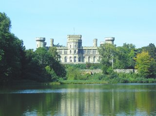
Eastnor Castle across the lake
I was fortunate enough to have spent much of my early childhood exploring and adventuring in the castles extensive grounds, dark winding stairways, forgotten attics and grand halls, or playing toccata and fugue very poorly on the chapels harmonium. The castles main rooms much of which are now open to the public have been redecorated many times through the castles life. In 1849 the 2nd Earl commissioned AWN Pugin to decorate the Gothic Drawing Room which he did after completing work at the House of Lords. The 3rd Earl Somers, Charles, undertook many of the embellishments of the castle during the 1860’s and 70’s and was at the forefront of contemporary taste. Charles also collected many classical antiques and art including the extensive collection of medieval armour and was also responsible for the planting of the beautiful arboretum.
The arboretum summer house
During the agricultural depression of the 1930’s the estate began to struggle financially and in September 1939 traditional aristocratic life at the castle came to an end and it was offered to the Australian High Commission in case they needed to leave London during the Blitz. The family moved first to a cottage in the grounds before returning to smaller private rooms of the castle where they lived quietly, directing their energies into agriculture and modernizing estate properties. The castle began to fall into disrepair and life proceeded in relative discomfort, trekking 50 yards from the bedrooms to the nearest bathroom, patrolling for roof leeks with buckets when it rained, collecting wood and clearing the roofs of snow.
Eastnor Castle from Ragged Stone Hill
When Hon. Elizabeth Somers Cocks died in 1986 her eldest son James wanted to live there and his then wife Sarah put unimaginable effort and thought into restoring the castle to its former glory, much of which is exactly as found today. With its intriguing history, expansive grounds and lake, great halls, dining room, drawing room, libraries, saloon, chapel and plethora of grand bedrooms Eastnor castle is a fascinating and beautiful stately home to visit and enjoyable for all the family, young and old alike.
As well as being open to the public
Friday, April 14, 2006
Still not an abandoned site...
This is another quick note to let any regular visitors no that this site has not become a forgetten corner of the internet. My University degree is nearing completion and I'm sure you can appreciate these are hectic times, which is why I'm all the more looking forward to continuing this blog as spring and summer unfold.
I'd also like to thank anyone who might be a regular visitor and everyone who's left nice and inspiring comments so far. I'll try to continue searching for interesting tales of the hills to bring you and am really yet to even touch upon the village of Eastnor itself.
I'd also like to point out an error on the 'Names & Heights...' diagram; Pinacle Hill is clearly taller than its neighbours, reaching 357 metres not 257 as shown.
Until further update here is a photoshop from a photo taken looking toward the Worcestershire Beacon from Broad Down, adjacent to the British Camp.
Wednesday, January 04, 2006
Between the two Camps
Rising from the Silurian pass moving northward toward the Herefordshire Beacon is the sinisterly titled Hangmans Hill, once the location of a gibbet originally constructed by the Red Earl. The Red Earl of Gloucestershire married the daughter of Edward I, Joan d'Arce, and in doing so received the rights to the Malvern chase upon which he made sure no one encroached.
Beyond Hangmans Hill the ridge turns slightly westward and rises sharply toward the ancient ramparts of the British Camp on Millennium Hill and the towering Herefordshire Beacon whilst to the east the fern covered Broad Down slopes gently into woodland.
On the western slopes between Hangmans Hill and the British Camp a small cave can be found in an outcrop of rock near the ridge. The caves most common names are Clutters Cave, Walm's Cave or the Giants' Cave. Though to children the stories of a giant in the cave may be exciting, there is actually little room for someone of average size to live comfortably, let alone a giant! However that name may stem from a story involving the Collwall Stone, that currently lies a few feet from it's original location as a centerpiece to a road junction near the centre of the village. The story goes that the giant saw his wife with another man in Collwall and in anger, ripped the stone from the hillside and hurled it at her, killing her on the spot. The resultant hole from which the stone originated being the Giants Cave.
The name Walms Cave comes from that of St Walms (or Waums) Well, which is on the slopes below the cave. Henry Somers-Cox suggested that this name could originate from a hermit or missionary that lived nearby, perhaps in the cave. It is thought that the cave may actually have been built by the Druids. There was once a panel, now barely visible, cut into the back wall of the cave, into which light was said to fall at 3 p.m. on the winter solstice. At the equinoxes the upper edge of the illuminated area coincides with the angle between the floor and back wall of the cave.
Monday, November 07, 2005
The Circle of Perpetual Choirs
The Magic Oak (Pagan Oak) is disputably at or near the centre of one such circle of choirs. There is so much contradicting information and speculation surrounding the Circle of Perpetual Choirs that I dare not venture into even attempting to provide factual information on this topic.
Below is a map by a local resident Madan (also a commenter on this weblog) that was left in the gnarled roots of the oak tree near Ragged Stone Hill.
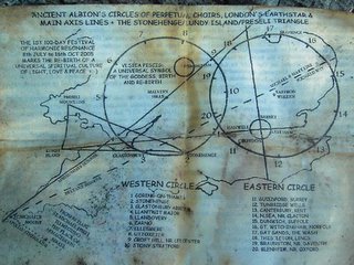
Map depicting the 'Circle of Perpetual Choirs'
For further information I would also highly recommend Awugabunnies, which features a wealth of information and detailed research into sacred geometries, including the Circle of Perpetual Choirs.
I would like to thank both Geoff and Madan for there comments on this post, and urge you to take a look.
Saturday, October 01, 2005
Writers Note...
I'd just like to point out the posting on this thread has merely paused and not stopped entirely. There's is still far more for me to publish concerning Eastnor and the Malvern Hills. After that perhaps I will increase the locality to include the quaint market town of Ledbury.
However I'm rather tied up with University now, and have little opportunity to rome the shire taking photos and generally being inspired. Rest assured though that posting will resume just as soon as possible though.
Thursday, September 15, 2005
The treasure at Bronsil Castle
A related tale tells of the Reede family who lived in the castle in the reign of James I. They found themselves frequently troubled by a restless spirit, perhaps even that of Lord Beauchamp himself. Desperate to find a solution they employed the services of a famous Wizard from the University of Oxford. The Wizard advised them to locate some of the late Lord Beauchamps bones and to keep them safe within the walls of the castle. So long as this was done the ghostly spirit would trouble them no more. They followed the Wizards advice and sure enough they were no longer haunted by the ghost. The bones were kept safely in a small cedar box labeled "Lord Beauchamps Bones" and over the decades became a family heirloom. So much so that when the castle burned to the ground the small wooden box was rescued from the inferno and moved to the Reedes new home, New Court near Lugwardine.
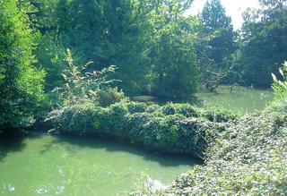
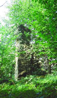
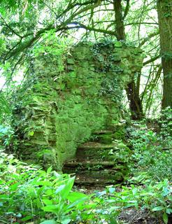
The castle was not huge but had four octagonal towers and was surrounded by two large moats, the inner of which still remains and contains water to this day. There is little left of the structure itself though, save the stone arch bridge across the inner moat, now shrouded in brambles and ivy, and small sections of two of the towers. The north east tower is a tall, narrow slither of stone, and the south east a low, wide section of wall with a handful of steps still visible and reasonably well preserved. The vast majority of the historic castle though, has regrettably toppled into the depths of the moat.
Wednesday, September 14, 2005
The Spirit of the Oak
A hollow of rock and root
And there beneath its shady bows
N'er a cruel path was trod
N'er a cruel path was trod
N'er a cruel path was trod
And there beneath its shady bows
They gave praise to the new Sun God.
In the winters darkness
When all life seems to pass
By the light of the flames they keep for warmth
The Spirits seem to dance
The Spirits seem to dance
By the light of the flames they keep for warmth
The Spirits seem to dance
As sure as spring will follow
The Oak will live again
And there they bring their gifts to hang
From the branches knarled and strong
The branches knarled and strong
The branches knarled and strong
And there they bring their gifts to hang
And join together in song
Of Earth and wood and stone
And all things of the land
By the light of the flames they keep for warmth
The Spirits seem to dance
The Spirits seem to dance
By the light of the flames they keep for warmth
The Spirits seem to dance
(Writtain by the Author 'The Glynch Bull'. Lyrics to a modern folk song concerning The Magic Oak)
Monday, September 12, 2005
The Pagan Oak (The Magic Oak)

 The Oak in Autumn
 Sunday, September 11, 2005
Midsummer Camp, Hollybush Hill & Dyn Mawr
Midsummer Camp seen from Hillend House
The time of the earliest encampment of Midsummer Hill is debatable, but it is quite plausible that it may have been enhabited prior to the Bronze Age, around 2000B.C., by pre-Aryan man bearing similarities with the Basques or Eskimos. At this time the rolling hills of Herefordshire would have been entirely covered with forest stretching westward to meet the Forest of Dean and as far as the Black Mountains in south Wales. It would have been safer to brave the elements on the exposed peaks of the Malvern ridge than to reside in the dark and unforgiving forests, which in the past would have been the home to many wolves and perhaps even mammoth, cave lion and bears.
However for the most part the camp would have been inhabited by Celtic Druids or “Ancient Britons” in the Iron Age. There are a number of clearly visible earthworks to this day. The fort ramparts are still clearly visible and encompass the top of both Midsummer Hill and it’s neighbour Hollybush Hill. In various periods of history it has been thought that the camp had a total of four entrances, however it has later been found that the other possible entrances are cut by the path of the Red Earls’ Dyke, made in a later period. There are in fact two gates; the north gate was the chariot gate, and is still clearly visible on the northern slope of Midsummer Hill. This would have been the main access route for those approaching the camp along the ridge of the Malvern Hills.
The south gate is situated in a narrow valley between the two hills and would have covered the old road from the Severn. At both of these gates the ramparts turn inward to create a narrow corridor through which attackers would have to pass, adding to their defensive nature. Many slopes on the interior of the fort are terraced and would have been the location of many dwellings. Man made hollows in the ground and sunken trenches from previous archaeological explorations can be seen in various locations across the two hills.
When the Druids took possession of the camp they both rebuilt and enlarged it and called it Dyn Mawr – in Celtic the “Great City”. It is thought that the city itself lay outside of the fort ramparts, lower in the valley below the south gate and in the pass now known as Hollybush. There were two springs to provide water, one within the fort itself and one within the city which would have fed four large reservoirs and dams, signs of which can still be seen today. Estimations at the number of inhabitants in the camp vary from early estimates of “at least 6000 men, entirely leaving out the ‘procestrium’ adjoining”, however later archaeological excavations have led to more believable estimates of between 1150 and 3460.
Upon the eastern flank of the fort upon Hollybush hill a long rectangular earth mound surrounded by a shallow trench is of debatable origin. Known as the ‘Pillow Mound’ it has been thought by some to be a Roman burial mound, and relics from both the Bronze and Iron Age have been found in excavations. However it is though more likely to have been an artificial rabbit warren constructed in the Medieval era or later.
The Ancient Britons were finally driven out of their encampments by the invading Roman army. It is possible that, having defeated Caractacus the Romans may have advanced southward attacking and finally defeating both the British and Midsummer Camps. These two camps may claim the honour of the last two British strongholds to fall to the Romans.
Saturday, September 10, 2005
Ragged Stone Hill

Ragged Stone Hill seen from Clenchers Mill Lane
There is much folklore and superstition that surrounds the ‘Accursed Shadow’ of the Ragged Stone Hill. One tale tells of how the curse was said to befall the family who at the time resided at Birtsmorton Court in Worcestershire. It was said that were the shadow to fall upon the house then the eldest son of the household would die within twelve months. There have even been numerous mysterious or unusual deaths and accidents attributed to the shadows curse.
One story entitled “The Shadow of the Raggedstone” by Charles F. Grindrod tells the tale of a monk who lapsed from his vow of chastity. He lived in the vicinity of the Ragged Stone Hill and his punishment was to climb unceasingly to the top of the hill on his hands and knees and descend in the same fashion. This sentence he was to serve every day and throughout every season, asking forgiveness of his sins with each step. After many months of this torment he reached the summit of the hill and rose up, outstretching his arms to the heavens exclaiming: “My curse be on thee, thou Heaven-blasting hill, and on those which laid this burden on me, and on all that be like as they are. May thy shadow and my shadow never cease to fall upon them, and upon this place which holdeth them.”
Immediately after proclaiming the curse the monk died and it is said that a strange dark column of dust clouds arose from the hilltop, seemingly to issue forth from the earth itself. It swelled to a vast size resembling in form the image of the monk, and slowly the huge dark cloud advanced across the hillside and over the valley that cowered below it.
A more probably origin of the legendary curse may stem from a much earlier period when the Druids encamped on the British and Midsummer Camps fought against the advancing Roman armies. Defeated and forced from their encampments the Druids made a last stand on the twin peaks of the Ragged Stone. In final despair they raised their voices and the brave and noble-souled men accursed all those who would fall under the shadow of the great hill, on which they were to imminently meet their end.
Though it may be impossible to be certain of the form and nature of the accursed shadow, for it is only present at certain points of the year and dependant upon the cloud layer, it would not be considered wise to find oneself sat in the shade of the mighty hill on a summers day. However, Rector Henry Somers-Cocks comfortingly reassured his parishioners that the shadow does not fall or does not hold sway upon the western, Herefordshire side of the hill. Fortunate this may be for the residents of Eastnor and neighbouring hamlets, but of little comfort to those who reside on the Severn plain in Worcestershire!

Ragged Stone from the summit of Midummer Camp
Names & heights of the hills and passes on the Malvern ridge
The Malvern Hills seen from the Severn plain
Friday, September 09, 2005
Geology
Geological Cross Section of the Malvern Hills
A division between Herefordshire and Worcestershire is created by the ancient granite rocks of the Malvern Hills, separating the rolling hillsides to the west from the flat Severn plain on the east. This creates three unique landscapes each with different geological origins.
The Malvern ridge - Malvernian Granite
The granite of the Malvern Hills was formed more than 600 million years ago during the Precambrian period, prior to the appearance of animals with hard parts and thus, no fossils exist. It seems that around 400-500 million years ago, during the Silurian period, the area was covered by a warm sea sheltering coral reefs and the vast myriad of life and organisms that such an environment sustains. Towards the end of this period this part of the world became unstable and tremendous pressures in the Earth’s crust forced the Precambrian granite upwards, taking the sea bed with it, and formed the ridge of the Malverns. The softer sediments of the sea bed were eroded away over time leaving the harder Malvernian granite ridge as we know it today. It was another phase of earth movement during this period that thrust the Herefordshire Beacon (British Camp) westwards.
There are a number of fault lines across the Malvern hills and these mainly run east to west creating several passes between the peaks, for example at the Gullet Quarry to the north of Midsummer Camp. To the east the hills are bounded by a fault line which runs from north to south.
To the west – Herefordshire - Limestone & shales
The Herefordshire landscape to the west of the hills consists of sedimentary rocks that are much younger than the granite of the hills themselves. They are formed by the sediment of the creatures coral and mud that were present when the area was covered by water. During periods when the sea was shallow mud was the main deposit and this results in shale. Deeper, clearer areas of the sea allowed for shelly deposits and coral reefs which later have formed limestone. Over hundreds and thousands of years limestone and shale have alternated and become tilted and twisted during the rise of the granite ridge and the formation of the Herefordshire Beacon. If one is to survey the scenery to the west of the hills at this time, the softer shales are mainly farmland while the harder limestone ridges and hilltops remain for the most part wooded.
To the east – Worcestershire – The Severn plain
During the periods following the Silurian it is probable that other layers were formed which have since been eroded away, with the exception of the eastern side of the ridge. Some 200 million years ago during the Triassic period Mercia mudstone (formerly Keuper Marl or Trias Marl) was deposited in inland lakes. Also during this period there was a continuing accumulation of red desert sandstones deposited by rivers and dunes. This has left flat beds of soft red sandstone across the plain.
Fairies in the Malverns
The Sun was low and the winds were still,
And never a whispering branch I heard
Nor even the tiniest call of a bird.
And when I came to the topmost height
Oh! but I saw such a wonderful sight,
All about on the hill-crest there
The fairies danced in the golden air,
Danced and frolicked with never a sound
In and out in a magical round;
Wider and wider the circle grew
Then suddenly melted into the blue.
As I walked down into Eastnor Vale
The stars already were twinkling pale,
And over the spaces of dew-white grass
I saw a marvellous pageant pass –
Tiny riders on tiny steeds
Decked with blossoms and armed with reeds
With gossamer banners floating far
And a radiant queen in an ivory car.
The beeches spread their petticoats wide
And curtsied low upon either side;
The rabbits scurried across the glade
To peep at the glittering cavalcade.
Far and farther I saw them go
And vanish into the woods below;
Then over the shadowy woodland ways
I wandered home in sweet amaze.
But Malvern people need fear no ill
Since fairies bide in their country still.
R.F. – in ‘Punch’, Aug. 28, 1918.
(Taken from ‘Eastnor and its Malvern Hills’ by Henry L. Somers-Cocks, M.A. – 1923)
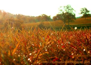
Eastnor Deer Park
Thursday, September 08, 2005
Introduction
Many of Edward Elgars compositions were inspired by the hills beauty and sensational views. William Langland, the medieval poet, was probably born on the western slopes and drew inspiration from the hill top views to write his epic poem, Piers the Plowman. By the mid-nineteenth century many well known men and women were drawn to the Malverns by the Water Cure, including Charles Darwin, Charles Dickins and Florence Nightingale. The famous nineteenth century soprano Jenny Lind known as the 'Swedish Nightingale retired to Wynd's Point near the Herefordshire Beacon.
The lush countryside that surrounds them is rich and varied. To the north and south the narrow ridge is seen as a series of rugged peaks, yet to the east the hills fall rapidly to the Severn plain which stretches away in gentle undulations towards the heart of England. The view to the west however is quite different. Rolling hills and ridges with varied woodlands and forests separated by small fertile valleys stretch out into the distance where the Black Mountains of south Wales can be seen upon the horizon. At the south west tail of the Malvern Hills nestles the vale of Eastnor a picturesque estate which boasts many points of interest and history.
In this Weblog I intend to share the local knowledge that I have and research further into the history and tales of this green and pleasant land tucked quietly away in the corner of the West Midlands. From the geology and geography of the hills, the structures, ruins and earthworks that can be seen, to the many tales and superstitions of giants, faerie folk, witches, and Druids. Whatever knowledge I can impart I shall put here for all to see.
I hope that the information I present here will be of interest to people near and far.
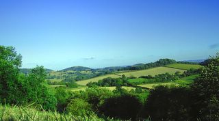
Southern tail of the Malverns seen from the Edge of the Frith Wood, Ledbury
Wednesday, September 07, 2005
References
This list shall be added to as the web log progresses.
SOMERS-COCKS, H.L. (1923) Eastnor and Its Malvern Hills. Hereford: Wilson & Phillips
MALVERN MUSEUM ASSOCIATION (1992) Ancient Hills. Malvern
LEATHER, E.M. (1912) The Folklore & Witchcraft of Herefordshire. Hereford: Jakeman & Carver
LEATHER, E.M. (1912) The Folk-lore of Herefordshire. Hereford: Jakeman & Carver
ANDERE, M. (1974) Herefordshire – The Enchanted Land. Hereford: Express Logic Limited
STANFORD, S.C. (1981) Midsummer Hill an Iron Age hillfort on the Malverns. Hereford: S.C. Stanford
RAVEN, M. (1996) A Guide to Herefordshire. Michael Raven
PALMER, R. (2002) Herefordshire Folklore. Woonton: Logaston Press
HERVEY-BATHURST, J.F.S. & S. (2003) Eastnor Castle. Derby: Heritage House Group Ltd.
Copyright Notice
If you hold the copyright for any of the source materials that I have referenced and feel I have infringed upon your copyright please, do not hesitate to inform me and the offending material shall be removed swiftly and without question.
Please ask permission before using any of the images or text from this site for your own purposes. I'm happy to give permission to people to use my work but like to know where and how it is being used and appreciate a credit and return link to this site.
Contact moggzmail@gmail.com or leave your comments here.
Many thanks.


